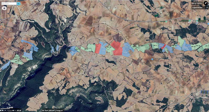
Management Panel
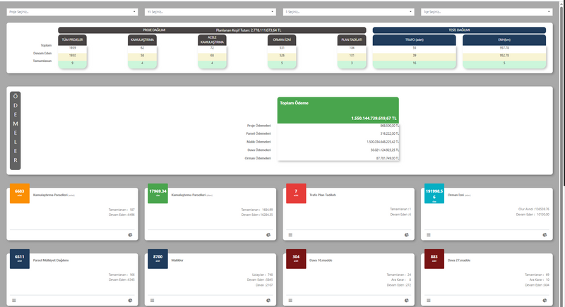
It is the main dashboard where general statistics on expropriation processes are displayed graphically.




Expropriation Management Platform
A system that manages expropriation and land acquisition processes on a single GIS-based platform.
OverviewHow it works
Track parcels, right holders and legal steps across the expropriation area.
Match the project area to ownership data.
Track valuation records and calculations.
Manage notification, agreement and litigation steps.
Link payment and registration status to the property.
Overview
Expropriation Management Platform is a GIS-based web software that enables expropriation, urgent expropriation, and land acquisition processes to be carried out in a digital environment.
Capabilities
Core Competencies
A system that manages expropriation and land acquisition processes on a single GIS-based platform.
Go to OverviewIt is the main dashboard where general statistics on expropriation processes are displayed graphically.
It is the screen where expropriation projects are created and managed. When registering a new project, information such as project name, type, status, expropriation type, and relevant institutional decisions is recorded...
It is the screen where the parcel boundaries and area information of the project are uploaded. By adding KML or map files, users automatically transfer information such as block-parcel, area, type, and map sheet...
It is the screen where the title deed, parcel, and attribute information of the properties subject to the expropriation process are recorded.
This screen is the area where all ownership details of property owners are managed. The user can view information such as the property list, share ratios, areas, and expropriation status of the selected person...
It is the screen where value assessment reports for expropriated properties are created. The user can view information such as the property’s location, area, expropriated area, actual status, and valuation criteria...
Capability Cards
The main modules are organized as concise corporate summary cards within the current page layout.
It is the main dashboard where general statistics on expropriation processes are displayed graphically.
This is the screen where expropriation projects are created and managed. When registering a new project, details such as the project name, type, status, expropriation type, and the relevant institutional decisions are recorded.
This is the screen where the parcel boundaries and area information of the project are uploaded. By adding KML or map files, users automatically transfer information such as block-parcel, area, land type, and map sheet into the system.
The Property Information Screen lets you track, monitor, and manage the relevant process on a single screen, in line with the corporate workflow.
The Owner Detail Information Screen lets you track, monitor, and manage the relevant process on a single screen, in line with the corporate workflow.
The Report Information Screen lets you track, monitor, and manage the relevant process on a single screen, in line with the corporate workflow.
The Notification Operation Screen lets you track, monitor, and manage the relevant process on a single screen, in line with the corporate workflow.
The Settlement List (Owner) Screen lets you track, monitor, and manage the relevant process on a single screen, in line with the corporate workflow.
Kaynaklar
You can access presentation and promotional content about Expropriation Management Platform from this section.
Product Tour
It is the main dashboard where general statistics on expropriation processes are displayed graphically.
This is the screen where expropriation projects are created and managed. When registering a new project, information such as the project name, type, status, expropriation type, and the relevant institutional decisions is recorded.
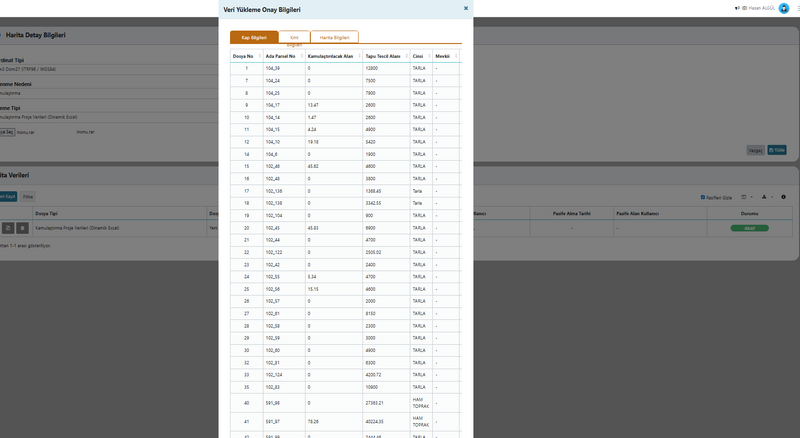
This is the screen where the parcel boundaries and area information of the project are uploaded. By adding KML or map files, users automatically transfer information such as block-parcel, area, land type, and map sheet into the system.
This is the screen where the title deed, parcel, and attribute information of the properties subject to expropriation are recorded. The user views or edits data such as the province-district of the deed, block-parcel number, area, map sheet, and location.
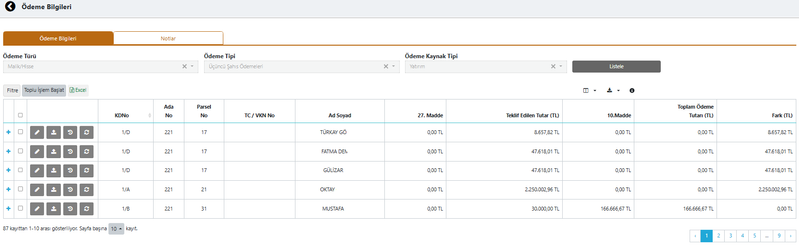
This screen is where all ownership details of property owners are managed. The user views information such as the property list, share ratios, areas, and expropriation status for the selected person.
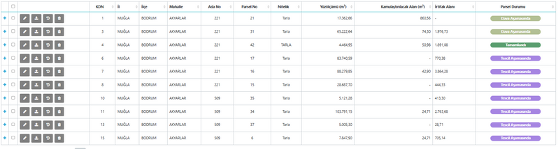
This is the screen where value appraisal reports for expropriated properties are created. The user views information such as the property location, area, expropriated area, actual status, and valuation criteria.
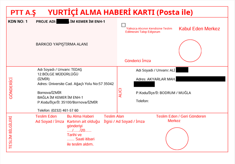
The preparation, sending, and tracking of notifications addressed to property owners during the expropriation process are carried out from this screen.
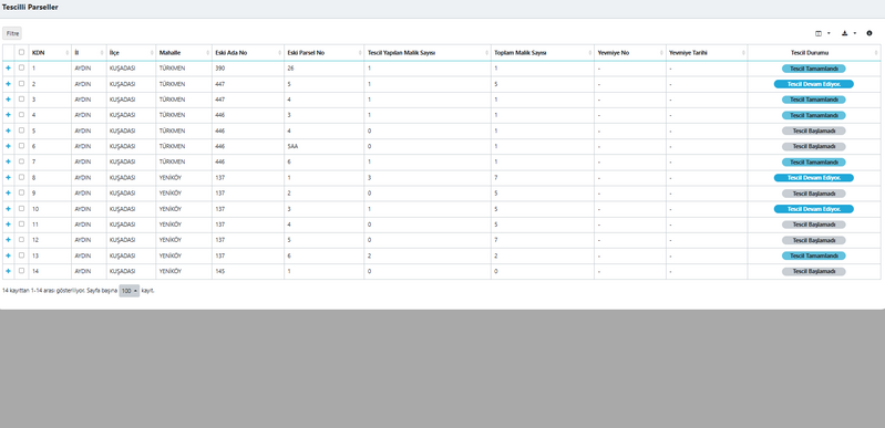
This screen is the section where settlement negotiations are managed on an owner basis during the expropriation process. For each owner, parcel information, share ratio, offered amount, and settlement status are shown in a table.
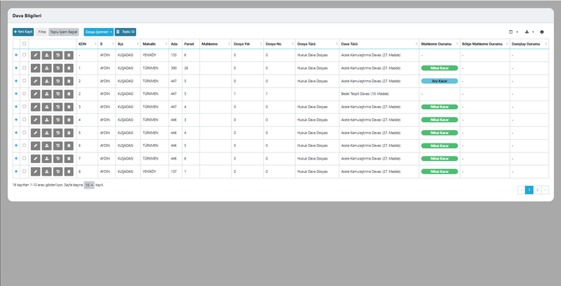
This is the screen where court and ruling information for lawsuits filed during the expropriation process is recorded. The user tracks the status of the case file, ruling dates, docket numbers, and the determined expropriation and easement amounts on this page.
This screen shows a general list of all payment items within the project. Each row includes the payment category, type, source type, transaction date, and payment status.
This screen enables the required documents within the project to be uploaded to the system. The user selects the document type from the list and adds the file to the system.
This screen is used to upload third-party documents related to properties into the system. The user selects the document type from the list and uploads the relevant file.
FAQ
The core use cases and corporate value of the product are summarized here.
Contact UsExpropriation Management Platform
Expropriation Management Platform is a GIS-based web software that enables expropriation, urgent expropriation, and land acquisition processes to be carried out in a digital environment.